Skip to content

Category: Operation

174. closing time

Bell, Recoleta Cemetery

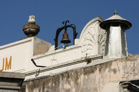
Hidden when viewing the entrance gate from the front, a single bell crowns the southern side. Closing time is announced by ringing the bell at 17:50, ten minutes before the gates are locked.

If you don’t notice the constant clang, no need to worry. Guards also patrol the grounds looking for straggling tourists. It’s probably not a great place to spend the evening.

Leave a Comment

155. map development 4

By early 2006, my general map was complete. But the entire project was put on hold since my walking tours were booming. It became impossible to juggle everything. Also, as I did more tours of downtown Buenos Aires, it seemed that a guidebook to that area was more important so I shifted focus to that.

At the same time, the Friends’ Association of Recoleta Cemetery (ADACRE) began publishing a map & selling it at the front gate for 4 pesos [Update: 2009 price is 6 pesos, 2011 price is 8 pesos]. Proceeds went to fund recent restoration work not done by any national or city organization in decades. Good for them. Although much better than previous maps, even their effort needed some improvement:
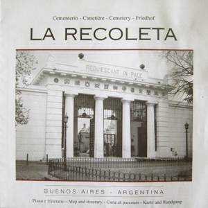
ADACRE map, Recoleta Cemetery

Both the foldable square format & the price were right. And 159 tombs were listed… many more than the 89 from the previous map. The interior contained a few black & white photos with a brief historical summary in Spanish, French, English & German. So far, so good.

But in an effort to be more inclusive, the design suffered. Due to space constraints, the only text that could accompany each name was a single word: President, poet, writer, politician. Most people outside Latin America have probably never heard of these people before, & a one-word biography seems worse than nothing at all. Finally, the list of personalities is not in alphabetical order & is not practical if you want to look for someone in particular:
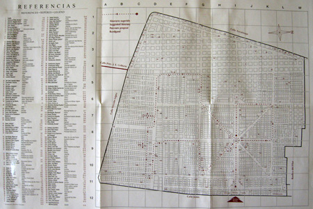
ADACRE map

But the biggest problem was the actual map itself. It looks like someone took the hand-drawn map pictured in Part 1 of this series, scanned it, & used it without editing anything. Lines are crooked & the tomb divisions are incorrect. The numbers used are placed haphazardly… no order at all. In the photo below, the entrance is shown with a huge range of numbers (#1, #42, #71 & #146). For easy use, the map should be arranged numerically or alphabetically, but this was neither:
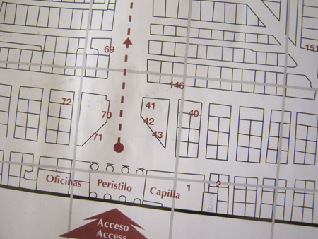
ADACRE map

The ADACRE map was by far the best yet, but apparently the graphic designer has little experience.

Read the complete story in the following posts titled “map development”: Part 1, Part 2, Part 3, Part 5, Part 6 & Part 7. Good news! The PDF guidebook is now available.
2 Comments

142. in the way

Very little evidence is left from the original 1822 cemetery. As the first public burial spot in Buenos Aires, Recoleta Cemetery wasn’t dignified enough to house the remains of elite families in its early days. They continued to prefer burial in churches. Early cemetery residents were buried haphazardly since space was available, & no one seemed to care much about organization in the beginning.

After the 1881 overhaul by Torcuato de Alvear, the cemetery’s layout was ordered & improved. Many plots were relocated to make room for the neat rows of mausoleums visible today. As far as I know, there are only two exceptions to this rule… they don’t fit on the map.

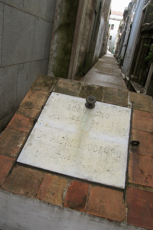
The tomb of Gabriel Ocampo sits in the middle of an aisle near the entrance, almost blocking access:

Gabriel Ocampo, Recoleta Cemetery

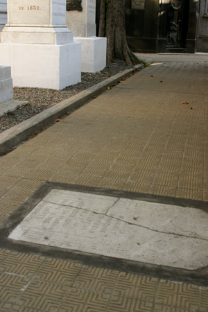
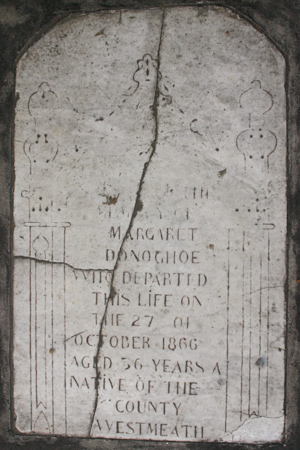
Many Irish Catholic immigrants still have their own tombstone from early days tucked in between modern mausoleums. But not Margaret Donoghoe. She was never moved & many people unknowingly walk over her cracked & worn tombstone:

Margaret Donoghoe, Recoleta Cemetery

Margaret Donoghoe, Recoleta Cemetery

1 Comment

134. official divisions

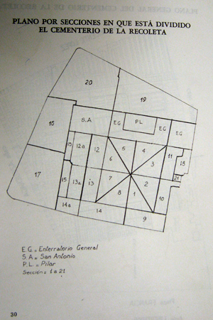
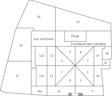
Although it’s well documented that the cemetery opened in 1822 & was later improved in 1881, there’s very little info in print about the official organization of family vaults. The following questions always get the best of me: How was it originally divided? What were the original limits of the cemetery? How did the current layout come about?

Fortunately, I found a book that provided some insight. During the last military dictatorship 30 years ago, a series of books & articles were printed by the city government under the collection name, Cuadernos de Buenos Aires. Elba Villafañe Bombal wrote #52 of the series in April 1974—published four years later in 1978—titled “Itinerario Histórico de Recoleta: Arte y Leyenda.” The volume is a valiant effort at cataloging the cemetery although there is a good bit of misinformation.

Obviously Bombal knew Recoleta Cemetery very well & was thorough in documenting its condition then, but perhaps she wasn’t the art & architecture historian she believed herself to be. Not to discredit her work, but several publications in later decades took Bombal’s text for granted without verifying sources. And to be fair, she credits a 1956 source by Jorge Kaudi called “Guía de Visitantes.” But that handbook is only a series of lists & cannot account for so many errors.

The one thing that intrigued me about Bombal’s book was the organizational map of the cemetery. I’ve reproduced it below using my own map as a guideline:

Official divisions, Recoleta Cemetery

Official divisions, Recoleta Cemetery

If sections were numbered as they needed to be used, then a sensible progression follows. I would make the assumption that sections 1 through 15 plus the named sections were the original limits of the cemetery. The anomaly of sections 18 & 21 were probably added later… which explains why that area is slightly higher than other parts of the cemetery.

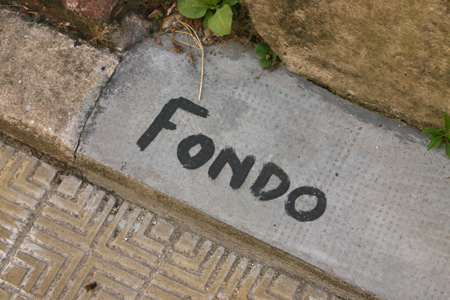
Looking at the intersections while walking around also reveals some clues. Little signage is available to guide the visitor, but painted words & numbers at ground level guide the staff within the various sections:

Official divisions, Recoleta Cemetery

More investigation to come…

Leave a Comment

110. map development 3

By mid-2004 it seemed practical to convert my website about Argentina into a blog. Spending a lot of time in Europe for work didn’t help me develop projects about Buenos Aires, but I thought Recoleta Cemetery was too important & too interesting to leave neglected.

The biggest hurdle was having to learn to use yet another program. After teaching myself HTML, Javascript, Flash, Photoshop, & CSS, the last thing I wanted to do was learn how to use Adobe Illustrator. But it had to be done. I took a photo of the Nov 2003 map at the entrance gate, imported it to Illustrator & began to trace the general layout of the cemetery… a good way to learn to use the program.

Once the rough master copy was complete, I began going to the cemetery almost daily to compare & correct. It was much more work than I expected. As I counted the number of actual vaults vs. those on the map, the difference was enormous. What to do? The easiest approach seemed to be to divide the cemetery into sectors & walk every aisle, counting the number of vaults as I went. Each day I’d input changes so I wouldn’t forget what I’d seen. It made for some interesting posts on my blog, & mapping took several months to finish.

Some of the stages are below with the original traced map in orange & the corrected version in blue:

Map development, Recoleta Cemetery

Read the complete story in the following posts titled “map development”: Part 1, Part 2, Part 4, Part 5, Part 6 & Part 7. Good news! The PDF guidebook is now available.

1 Comment